What are contributions?
Each project has categories, and every category has contributions which have been added to that project. Again, each contribution can contain text information, images, audio and videos files, comments.
Contributions are added by contributors of a project. If project’s settings allow it, every person accessing that project can be a contributor.
What do they look like?
Added contributions can be visible on the map: either as the shape of an area, a line, or a simple point.
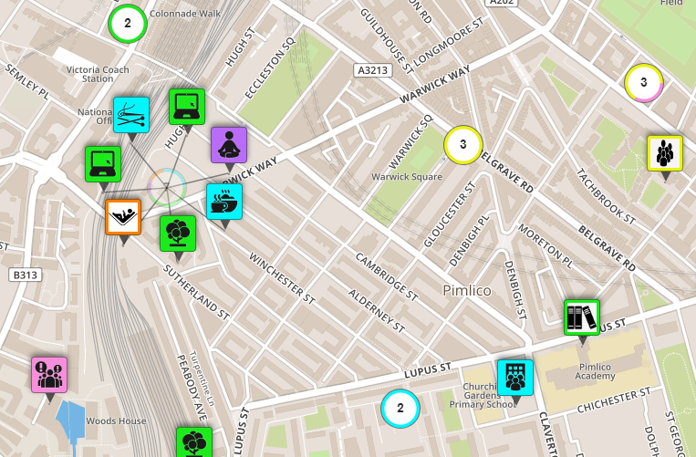
Points
Points are used for mapping single spots on the map; They are usually identified with a bespoke icon and are the same colour as the category used.
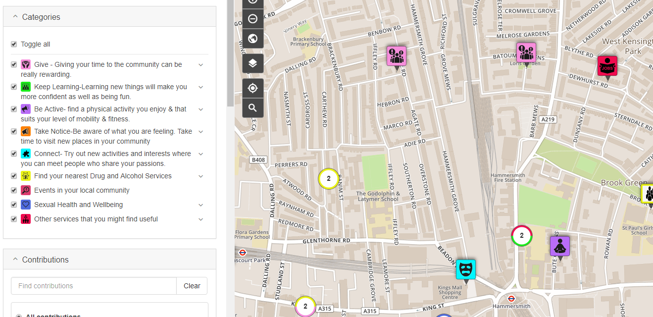
When there are too many points next to each other, they are grouped into clusters. A number on each cluster indicates how many points are grouped together and the colours in a cluster indicate the categories to which points in the cluster belong. As you zoom out, points are assigned to fewer clusters. When you zoom in, more clusters appear.
Lines
Lines are used for mapping paths, roads, etc. When visualised, they appear as the colour of their selected category.
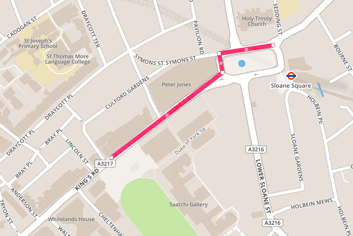
When drawing a line on a map, points are added alongside the path. Those points are then connected together to form a single line. The shape is finished with a mouse click on the last point.
Areas
For mapping bigger objects on the map, such as a green space, areas are used. When visualised, they also appear as the colour of their selected category.
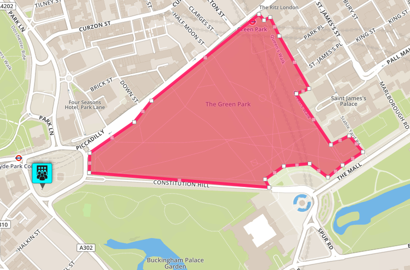
Drawing an area is very similar to drawing a line. The only difference is that the last point of the shape is the first point added. Areas also have the same colour backgrounds as the category chosen.
What’s next?
↳ Let’s learn how to access contributions